Hi, I'm Igor Milanoviฤ‡

Freelance Geodetic Engineer & Civil 3D Specialist

I help construction and engineering companies with survey data preparation, road design, and the creation of accurate models, quantities, and technical reports โ€” delivering reliable results for infrastructure projects worldwide.

Igor Milanovic

My Clients

These companies have trusted me with both on-site and remote engineering work, including survey data analysis, Civil 3D modeling, and technical reporting.

About Me

Igor Milanovic - freelance geodetic engineer

I am a freelance Geodetic Engineer and Road Construction Specialist with strong expertise in survey data analysis, technical reporting, and infrastructure design support, primarily using Autodesk Civil 3D.

I work with engineering and construction companies to transform raw survey data into accurate, structured, and construction-ready information. My focus is on road and infrastructure projects, where precision, clarity, and reliability are critical at every stage โ€” from early design to execution and quantity control.

My services include:

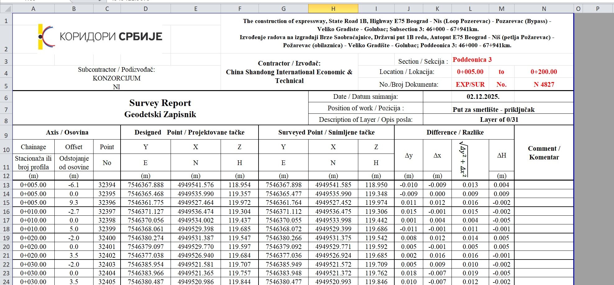
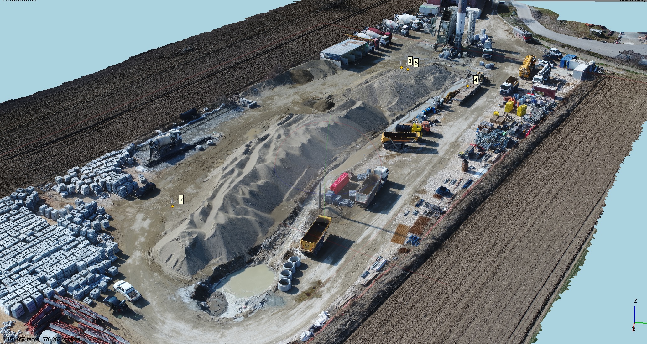
  • Analysis and processing of geodetic and survey data

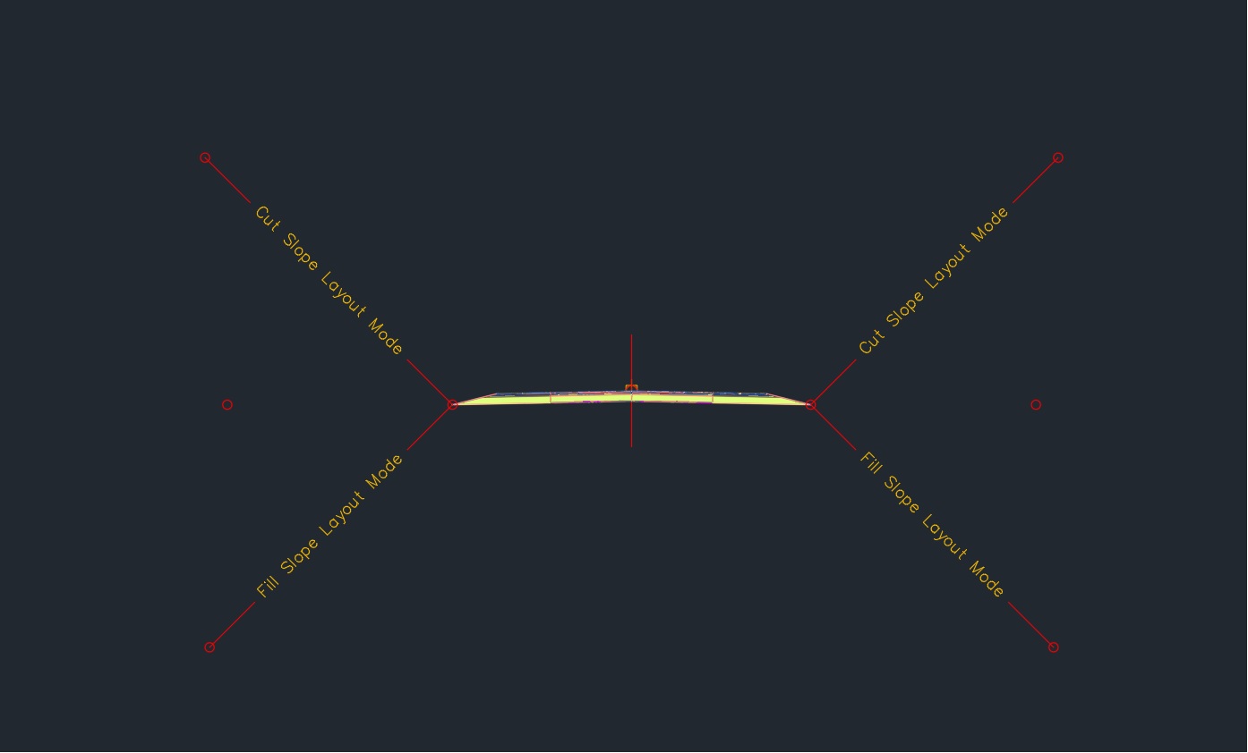
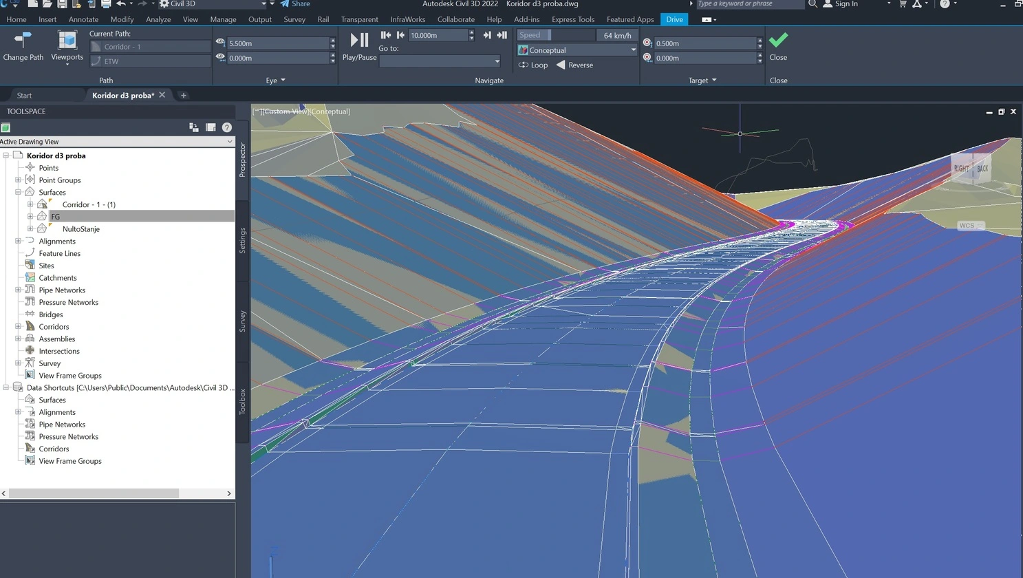
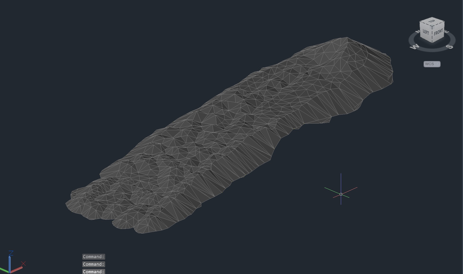
  • Creation and optimization of alignments, profiles, corridors, and surfaces in Civil 3D

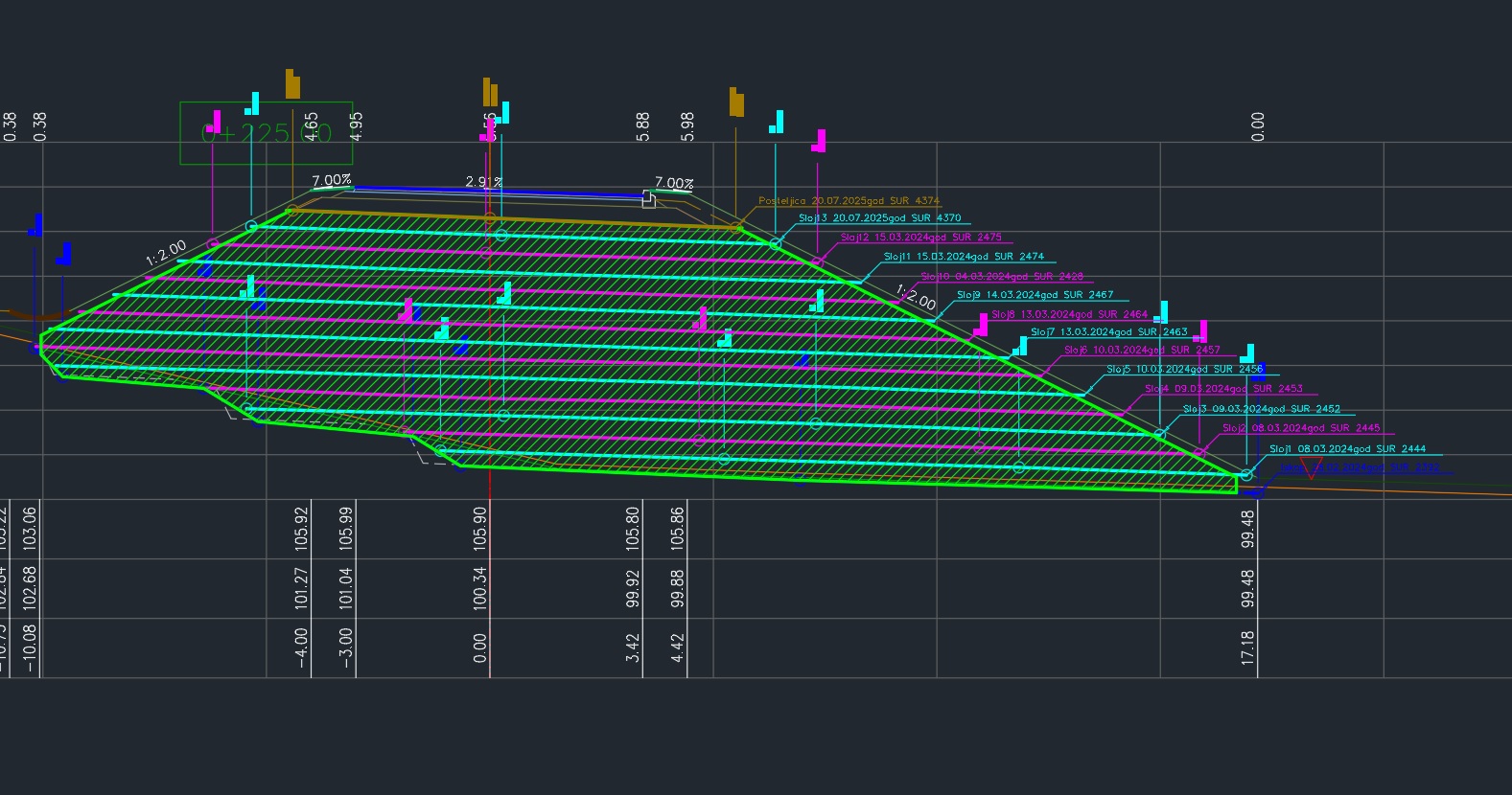
  • Earthworks and quantity calculations (cut/fill, volumes, cross sections)

  • Preparation of clear technical documentation and reports for design, tendering, and construction

  • Support for remote engineering teams with fast turnaround and consistent standards

I understand both the engineering theory and the practical demands of construction sites, which allows me to deliver results that are not only technically correct but also usable in real-world workflows.

I work fully remotely, collaborating with international teams while maintaining high professional standards, clear communication, and strict attention to deadlines. Clients value my accuracy, reliability, and ability to integrate seamlessly into existing project workflows.

If you need a dependable Civil 3D professional to support your road or infrastructure projects with precise data, clean models, and actionable reports โ€” Iโ€™m ready to help.

What I Do

Corridor in civil 3d

Design-to-Field Data Preparation

I specialize in transforming complex design data into actionable field-ready formats. I extract and structure critical points, alignments, and surfaces for setting out, ensuring that field crews have precise, error-free inputs for GPS and Total Station controllers.

Corridor 3d view - road design - cut/fill

Road Design & Civil 3D Modeling

I develop road design models in Civil 3D, including alignments, profiles, corridors, and cross sections, fully aligned with project standards and construction requirements.

Volume & Quantity Calculations

Volume & Quantity Calculations

I calculate precise earthwork quantities, cut/fill volumes, and material takeoffs, supported by clear visualizations and models, providing reliable data for planning, cost estimation, and construction control.

As-build layers of road construction

As-Built Documentation & Reporting

I prepare accurate as-built models, drawings, and reports based on field measurements, reflecting the executed condition of road and infrastructure projects.

Geodetic survey report

Technical Reporting & Documentation

I prepare clear and structured technical reports, drawings, and quantity summaries to support design decisions, approvals, and construction execution.

Drone Photogrammetry Processing & Analysis

I process and analyze drone-based photogrammetry data to create accurate surfaces, 3D models, and volume calculations, supporting design, construction, and material quantity verification.